-Information and weather charts courtesy Brian K. Short, Director of Emergency Operations, Henderson-Vance County Emergency Operations and the National Weather Service
In case of a power outage, remember to tune in to WIZS Radio at 100.1 FM / 1450 AM with a regular radio.
Click here for the LATEST BRIEFING FROM THE NATIONAL WEATHER SERVICE
You may report weather delays and cancellations by email to news@wizs.com or by text at 432-0774. Delays and cancellations will be posted on the WIZS Facebook page – click here – and announced on the air for this event.
——————————————————————————————————————————————————
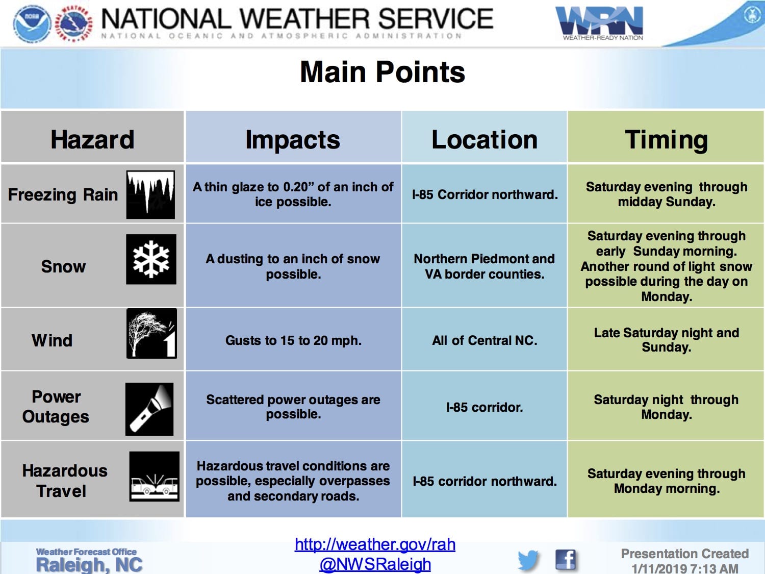
Forecast: Forecasted freezing rain amounts have increased while forecasted snow accumulations have been lowered.
Confidence: High confidence that the event will occur; moderate confidence regarding snow/ice amounts and impacts.
Timing: Wintry weather and its impacts are possible Saturday evening through Monday. The heaviest precipitation is expected to fall Saturday night through about mid-morning Sunday.
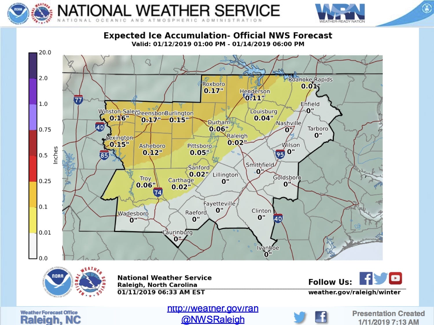
Amounts: Light snow accumulation is possible across the northern Piedmont and VA border counties with amounts ranging from a dusting to near an inch. Freezing rain (ice) accumulations are also possible mainly north and west of U.S. Route 1 with amounts ranging from a thin glaze to as much as two tenths (highest north of I-85 and the Triad area).
Impacts: Travel may be impacted by light snow and/or ice accumulations, particularly north and west of Interstate 85. It is possible that we may see some power outages with this event, but we do not believe they will be widespread.