Tag Archive for: #nationalweatherservice

Microclimates, Hot Weather, Thunderstorms, Hurricanes and Forecasting

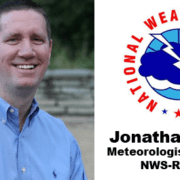
They probably don’t teach terms like “crazy hot” in meteorology school, but everyone around here knows firsthand exactly what Jonathan Blaes means when he says those words to describe this summer’s weather.

Blaes, director of the National Weather Service office in Raleigh, summarized the current weather pattern that has sent temps soaring into the triple-digit range across parts of the Midwest and West.

“In Texas and Arizona, it’s been crazy hot without a break for months,” Blaes said on Tuesday’s TownTalk.

North Carolina summers often see stretches of hot weather for days in a row, but not months. “This (pattern) has been pretty persistent and pretty remarkable,” he added.

The thunderstorms that blew through the area earlier this afternoon are ushering in a slight break in the heat and humidity, with predicted highs hovering in the mid- to upper 80’s for the rest of the week.

Heat and humidity are the basic fuel for thunderstorms, Blaes said, so why don’t we have thunderstorms every single day during the summer?

We feel the heat and humidity down here on the ground, but there are other factors that affect the likelihood that afternoon storms will pop up, he explained. Take the temperature of the air at higher elevations, from cloud level and beyond, for example.

Temperatures need to cool off at a steeper rate to fuel storms, so when it’s “hot all the way up into the clouds,” that cooling doesn’t always occur at the rate needed to create storms.

But there are other factors closer to earth that have a bearing on the weather, including soil makeup, elevation and bodies of water, just to name a few.

“Weather is very local,” he said. “Details matter. Locations matter,” he added. “All those different features and materials interact with the air and sunlight and they’re different.” Those differences help to drive the weather patterns in a particular area, both in the short-term and long-term.

And Blaes and his team consider all those factors when they make their forecasts.

The National Weather Service team is keeping an eye out as hurricane season continues. There already have been four named storms, and we’re barely three months in, he said.

The NOAA forecast is calling for above normal activity this hurricane season, with between 14 and 21 named storms.

Typically, we can count on 14 named storms. Of that number half, will become hurricanes. Of that seven, half of those will be Category 3 or stronger, Blaes said.

“Things are going to ramp up and you can place a pretty good wager we’re going to be hearing more about tropical storms in the Atlantic,” he said.

Thanks to sophisticated technology advances, forecasts are more data-driven and less prediction or educated guesses.

In the event of a hurricane between now and November, Blaes said one thing he’d for sure recommend is to prepare a hurricane kit and make a plan. Just in case.


CLICK PLAY! 

Granville County Emergency Management

Granville County To Host SKYWARN Training April 11 At Expo Center

Learn how to become a volunteer weatherspotter for the National Weather Service at a training in Oxford, Tuesday, April 11 at 6:30 p.m.

Granville County Emergency Management is hosting a SKYWARN Severe Weather Spotter Training at the Granville County Convention and Expo Center. This is a free event and open to the public. Registration is not required – just show up at 6:30 p.m. to learn about SKYWARN.

SKYWARN volunteers support their local community by providing the NWS with timely and accurate severe weather reports. These reports, when integrated with modern NWS technology, are used to inform communities of the proper actions to take as severe weather threatens. The key focus of the program is to save lives and property through the use of the observations and reports of trained volunteers.

For more information, contact Granville County Emergency Management at 919.603.1310.

The Local Skinny! Blaes Says The Next Two Weeks Is The Best Chance For Snow

We’re almost one week into the New Year, but already in 2022, North Carolina weather is living up to its reputation of having a little something for everyone. Love milder temps in winter? Check. The high in Henderson was 75 on Jan. 1.

Prefer to have some snow in the forecast to make it feel like it supposed to feel this time of year? Check. A wet snow fell fast and heavy on Monday in the area, but it went as quickly as it came.

Jonathan Blaes with the National Weather Service says that this could be a pattern we can expect, at least for the next couple of weeks.

“It was a really neat storm,” the meteorologist said of the short-lived event that blanketed the area Monday.

Blaes said the dynamic storm system brought a bit of everything to the state, from high winds and at least one tornado in Harnett County and up to several inches of snow near the Virginia border. “A vigorous front will come through tonight (Thursday), and tomorrow will be a crazy windy, blustery day,” he said.

It’ll turn cold behind the next front, too, so it will feel like winter for the next week or so.

If you’re a snow lover, and the next 10 days or two weeks doesn’t do it for you, take heart, Blaes said. Historically, late January brings with it the chance of more wet snow.

From what he and his fellow meteorologists can tell so far from studying global weather patterns, it’s possible that over the next couple of weeks the area could have additional snowfall.

“It’s certainly going to be close enough so if a storm tracks close enough (to the area), we could get some snow.”

The messy mix of precipitation – rain, freezing rain, sleet, snow and then back to rain – is what this area is used to seeing. Meteorologists classify this type of storm as a “Miller A,” which indicates that the storm moves as a single low front tracking from the south. This week’s storm wasn’t a classic Miller A, Blaes said, but the area did see a changeover from rain to snow, back to rain before skies cleared and the sun reappeared.

“If you’re in the right spot, you’ll get clobbered,” from such a storm, like the areas around Washington, DC where almost a foot of snow fell and motorists were stranded overnight on I-95 near Fredericksburg, VA.

Click Play

National Weather Service

Threat of Stormy Weather Christmas Eve

The latest National Weather Service briefing includes the possibility of stormy, maybe even severe, weather for the WIZS area.

You can always see the Latest Briefing of from the National Weather Service by clicking this link.


While the strongest, most wide-spread weather is expected along and east of the I-95 corridor as of this posting (at 9:30pm Wednesday), the fact remains the severe threat has shifted closer to our area in the last 24 hours.  Does it shift closer, stay the same or move more to the east?  Those facts and the timing will be revealed Thursday as the frontal boundary approaches.

The big questions are how warm and unstable it becomes in Vance County on Thursday, how far down the strongest winds aloft can reach towards the surface and if the greatest instability and “supercell” thunderstorms stay more to the east.

For now, the latest forecast, courtesy of the National Weather Service: Click here or read below for the period Thurs-Sat.

Thursday: Showers, with thunderstorms also possible after 1pm. High near 64. South wind 10 to 18 mph, with gusts as high as 36 mph. Chance of precipitation is 100%. New rainfall amounts between a half and three quarters of an inch possible.

Thursday Night: Showers and possibly a thunderstorm before 1am, then a chance of showers. Low around 31. South wind 14 to 18 mph becoming west after midnight. Winds could gust as high as 36 mph. Chance of precipitation is 90%. New rainfall amounts between three quarters and one inch possible.

Christmas Day: Mostly sunny, with a high near 35. West wind 11 to 14 mph, with gusts as high as 23 mph.

Friday Night: Mostly clear, with a low around 18. West wind 6 to 9 mph.

Saturday: Sunny, with a high near 40.

Saturday Night: Mostly clear, with a low around 24.

Sunday: Sunny, with a high near 50.

Dangerous Heat Continues Through Weekend for Central NC

100.1 FM / 1450 AM WIZS; Local News broadcasts M-F 8am, 12pm, 5pm

-Press Release, National Weather Service 

The combination of hot temperatures and high humidity will produce dangerously high heat index values on Friday. The situation will get worse Saturday and Sunday when excessive heat is expected, with limited cooling at night.

The National Weather Service in Raleigh has issued a Heat Advisory, which is in effect from noon to 7 p.m. EDT on Friday.

An Excessive Heat Watch has also been issued. This Excessive Heat Watch is in effect from Saturday through Sunday evening.

Graphic courtesy the National Weather Service.

Heat Index Values

The heat index will be up to 105 degrees Friday. Then, heat index values potentially may soar to between 110 and 112 degrees for Saturday and Sunday afternoons. Heat indices will likely remain between 80 and 90 all night through the period, greatly increasing the potential for heat-related illnesses.

Timing

The most dangerous time will be between noon and 7 p.m. Friday, then all of the weekend. It will not cool below 80 degrees over many areas until 4 or 5 in the morning.

Impacts

Dangerously high temperatures and humidity could quickly cause heat stress or heat stroke if precautions are not taken. In addition, consecutive days of dangerous heat will continue into the weekend, when the heatwave will reach a peak.

Consecutive days of dangerous heat indices have a cumulative effect on the body, significantly increasing the potential for heat-related illnesses.

Precautionary Actions

Drink plenty of fluids, stay in an air-conditioned room, stay out of the sun and check up on relatives and neighbors.

Take extra precautions if you must work or spend time outside. When possible, reschedule strenuous activities to early morning or evening. Know the signs and symptoms of heat exhaustion and heatstroke. Wear lightweight and loose-fitting clothing when possible and drink plenty of water.

To reduce risk during outdoor work, the Occupational Safety and Health Administration recommends scheduling frequent rest breaks in shaded or air-conditioned environments. Anyone overcome by heat should be moved to a cool and shaded location.

Heatstroke is an emergency – call 911.

For additional information and tips, visit the National Weather Service website (click here).


National Weather Service

Winter Storm System Expected to Affect Portions of Central NC

-Information and weather charts courtesy Brian K. Short, Director of Emergency Operations, Henderson-Vance County Emergency Operations and the National Weather Service

In case of a power outage, remember to tune in to WIZS Radio at 100.1 FM / 1450 AM with a regular radio.

Click here for the LATEST BRIEFING FROM THE NATIONAL WEATHER SERVICE

You may report weather delays and cancellations by email to news@wizs.com or by text at 432-0774. Delays and cancellations will be posted on the WIZS Facebook page – click here – and announced on the air for this event.

——————————————————————————————————————————————————

Forecast: Forecasted freezing rain amounts have increased while forecasted snow accumulations have been lowered.

Confidence: High confidence that the event will occur; moderate confidence regarding snow/ice amounts and impacts.

Timing: Wintry weather and its impacts are possible Saturday evening through Monday. The heaviest precipitation is expected to fall Saturday night through about mid-morning Sunday.

Amounts: Light snow accumulation is possible across the northern Piedmont and VA border counties with amounts ranging from a dusting to near an inch. Freezing rain (ice) accumulations are also possible mainly north and west of U.S. Route 1 with amounts ranging from a thin glaze to as much as two tenths (highest north of I-85 and the Triad area).

Impacts: Travel may be impacted by light snow and/or ice accumulations, particularly north and west of Interstate 85. It is possible that we may see some power outages with this event, but we do not believe they will be widespread.


National Weather Service

Forecasters Predict ‘Significant Snowfall’ for Area; When & How Much Still Uncertain

-Information and weather chart courtesy Brian K. Short, Director of Emergency Operations, Henderson-Vance County Emergency Operations and Ready NC

Below is a briefing slide from the National Weather Service regarding a significant storm system that will affect our area over the weekend. The storm is still a few days away, making a definitive forecast difficult, but all indications are that we could receive significant snowfall before the system moves out on Monday.

A mixture of rain, freezing rain, sleet and snow are possible depending on the timing and where exactly the low pressure tracks along our coast. Again, while nothing is certain, confidence is high that we could see a significant winter event with this storm.

We will continue to forward along additional information as it is received. Please visit www.weather.gov/raleigh anytime for updated information.


National Weather Service

Heavy Rain Expected Early This Week, No Threat of Winter Weather

-Information courtesy Brian K. Short, Director of Emergency Operations, Henderson-Vance County Emergency Operations and the National Weather Service 

The National Weather Service is forecasting a very wet start to the week with upwards of 3 – 4 inches of rain expected in most locations through Tuesday. Urban and small stream flooding is possible. There is a chance for an isolated thunderstorm particularly in the east. Main stem rivers will need to be monitored for potential river flooding later this week.

A second system on Thursday appears to be all liquid at this point despite predicted temperatures very close to freezing in the Triad and VA border counties. Sunny and cool for the weekend. The potential tropical system in the Atlantic poses no threat to central NC at this time.

At this time there is NO threat for impactful winter weather in central NC this week. Triad and VA border counties will have temperatures near freezing for a couple of hours Thursday morning around sunrise. This may possibly be enough to get a pellet or two of sleet on the windshield mixed in with the rain but otherwise should remain all liquid. Even if temperatures do briefly touch 32 degrees, any ice accrual is unlikely because of warm antecedent conditions. Warm ground temperatures and air temperatures prior to the onset of the precipitation would prevent any freezing rain accrual. Temperatures will quickly rise through the 30s after sunrise, further mitigating any chance of winter weather.

National Weather Service

Severe Weather Predicted for Thursday Evening, All Day Friday

-Information and weather charts courtesy Brian K. Short, Director of Emergency Operations, Henderson-Vance County Emergency Operations 

According to the National Weather Service, there is a marginal risk for severe weather Thursday evening through Friday evening.

Severe weather may include isolated thunderstorms that develop late tonight and toward daybreak on Friday across the Coastal Plain and the eastern Piedmont. A strong to severe storm is possible with a primary threat of wind gusts in excess of 50 MPH, which may produce downed trees and power outages.

National Weather Service

Total Rainfall Amounts From Tropical Storm Michael

-Information courtesy Brian K. Short, Director of Emergency Operations, Henderson-Vance County Emergency Operations

The National Weather Service – Raleigh recently completed an analysis of 887 rain gauge sites across the state of North Carolina, looking at total rainfall associated with Tropical Storm Michael.  The map below is the result of this analysis and shows total rainfall during October 11-12, 2018.

The data for each of the sites was quality-checked for accuracy, and sites were only included if there was no missing data during the aforementioned time frame.