-Information and weather chart courtesy Brian K. Short, Director of Emergency Operations, Henderson-Vance County Emergency Operations and Ready NC
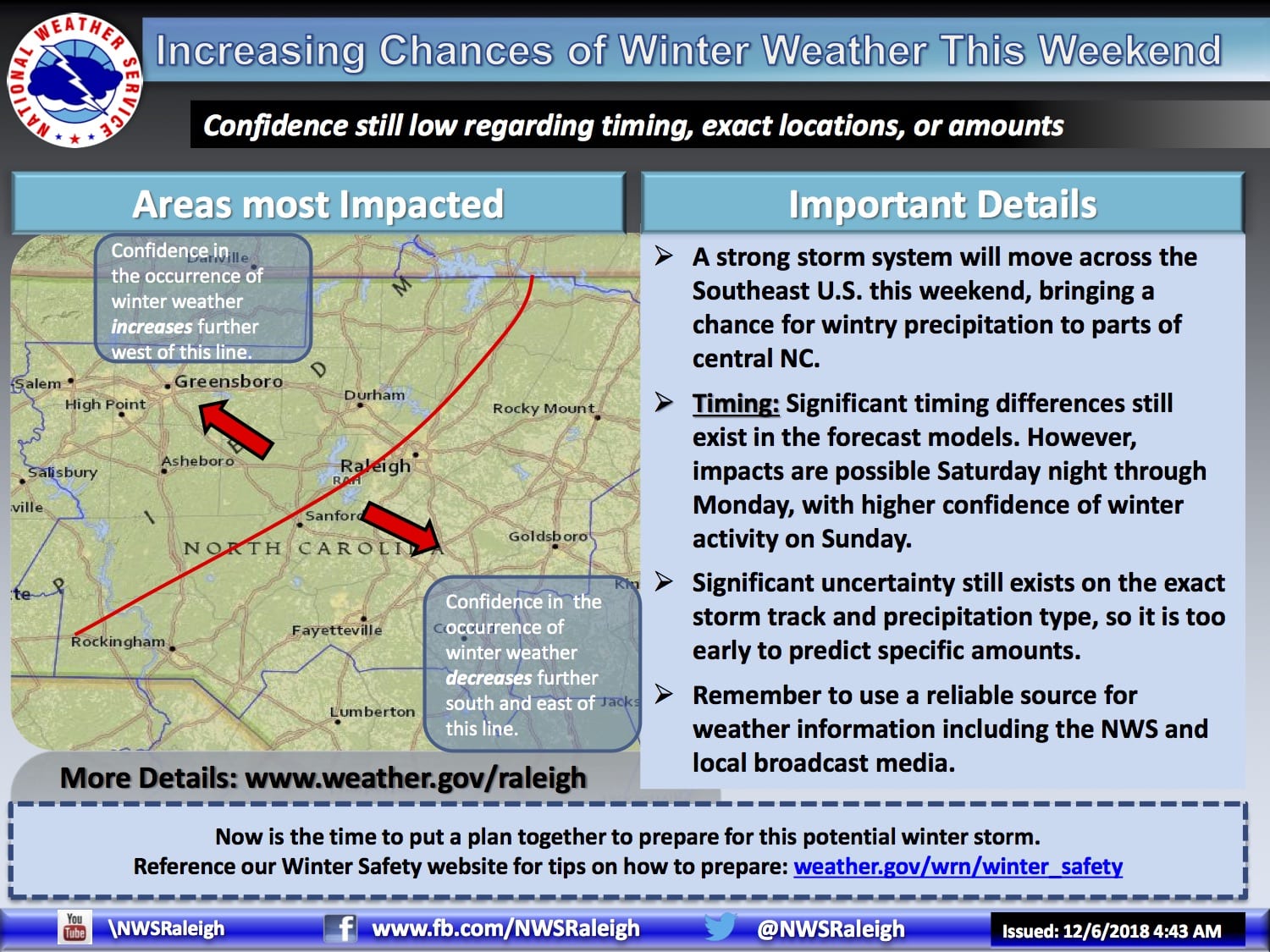
Below is a briefing slide from the National Weather Service regarding a significant storm system that will affect our area over the weekend. The storm is still a few days away, making a definitive forecast difficult, but all indications are that we could receive significant snowfall before the system moves out on Monday.
A mixture of rain, freezing rain, sleet and snow are possible depending on the timing and where exactly the low pressure tracks along our coast. Again, while nothing is certain, confidence is high that we could see a significant winter event with this storm.
We will continue to forward along additional information as it is received. Please visit www.weather.gov/raleigh anytime for updated information.