Tag Archive for: #vancecountyemergencyoperations

Precip to start Sooner; Snowfall Estimates Higher

Precip to start Sooner; Snowfall Estimates Higher

Brian Short is the Director of Emergency Operations for Vance County and Henderson.  He has attached here – click here – the latest weather synopsis from the NWS for the winter storm that is headed our way.

Short has been communicating regularly with emergency preparedness teams, local officials and local media over the last few days, and in his most recent email update, Short said, “Presently we are under a Winter Storm Warning. The timing of the event remains roughly the same, but as you can see our snowfall estimates have increased noticeably overnight.

“At this time we have no plans to open any shelters as we do not expect widespread power outages. Once the snow begins we are encouraging residents to stay off the roads. Snow accumulations are forecast to be heavy. Unnecessary travel during wintry conditions not only puts the driver at risk it also hampers road clearing efforts.

“We will be continuing to coordinate with local and State response agencies throughout the storm and will continue to forward along additional information as it is received.”

Additionally, if you are a member of a local emergency preparedness team or a local public official in need of anything further, you are reminded to contact Short directly.


Winter Storm Warning Issued; Vance Preparing

Winter Storm Warning Issued; Vance Preparing

THE NATIONAL WEATHER SERVICE IN RALEIGH HAS ISSUED A WINTER STORM WARNING…WHICH IS IN EFFECT FROM 7 PM FRIDAY TO 7 PM EST SATURDAY – click here for more

Brian Short, Director of Emergency Management for Vance County and Henderson, has provided the latest briefing from the NWS regarding the winter weather event that will be moving into the area tomorrow and into Saturday.

Click here for the latest National Weather Service briefing – 4:15 p.m., January 5, 2016

In his afternoon email to local preparedness groups and local media, Short said, “Our snowfall totals have increased a little throughout the day and there is certainly the potential for us to receive substantial snowfall by the time this event finally subsides late in the day on Saturday.

“We have spent the majority of the day today coordinating with our local and State response partners. If this event does not diminish or worsens by tomorrow, we will likely be implementing a local State of Emergency that would remain in place as long as needed.

“We have no plans to open shelters at this time. This is the posture that we typically take during winter weather events especially when the likelihood of widespread (power) outages is not expected.

“The 911 communications center will be overstaffed and will remain overstaffed as long as it is warranted. We remain poised to take further action if it should become necessary.

“We do ask that once the snow begins to fall, that everyone please stay off the roads unless absolutely necessary as travel will likely become hazardous. This will also allow our road crews to do their jobs and scrape the roads as effectively as they can.

“Additional information will be forwarded along as it is received.”

Clark Elementary School – Active Shooter Exercise

On Saturday November 19th, 2016 Vance County Public Safety agencies as well as emergency responders from our surrounding counties will be conducting a full scale active shooter exercise at Clarke Elementary School, located at 309 Mount Carmel Church Road, in Henderson.

Vance County received a grant in the amount of $20,000.00 through the Federal Homeland Security Exercise Program to conduct the training event, which has been in the planning stage for the past six (6) months.

It is our intent to make this exercise as realistic as possible while preserving the safety of all those involved. Simulated gun fire will be used as well as injury simulation (Moulage) to add realism.

The exercise will take place on Saturday rather than a regular school day due to the age of the students, however roughly 250 Vance County School’s personnel (many of them actual teachers) will be portraying students to further add realism to the scenario.

While we have conducted similar exercises to this in the past, each school is unique and offers its own unique challenges. Clarke Elementary was chosen as it is the newest school in the County and is probably not as well-known to our responders as some of the other school facilities.

Early preparation for the exercise will begin at 7:00 AM on that day with the exercise itself beginning later that morning. The exercise will conclude early in the afternoon on that same day. We would like to caution residents in the area that they may hear the simulated gunfire and would like to emphasize that they should not be alarmed by those sounds. Additionally, there will be a large public safety presence in and around the school for the duration of the event which will include law enforcement, EMS, fire and even helicopters, but again we would like to stress that this is all a part of the exercise.

Further, we will be closing off certain sections of the roads in and around the school to allow us to adequately test our perimeter control methods. Residents that live in the confined area will be contacted to make them aware of what is happening and they will be allowed to come and go if they should need to. Through traffic will be routed around the exercise venue until the event is over.

This exercise is NOT open to the public. Anyone not affiliated with one of the participating agencies who approaches the exercise area will be turned away. You do not have to get disheartened as you can easily navigate to this website and find easy ways to build yourself a relaxing time. It is unfortunate that we must prepare for such a horrible event but we owe it to our citizens and our communities to ensure that such public environments are as safe as possible. Through joint efforts such as this exercise we ensure that a coordinated response will occur during an actual event.

Contact: Brian K. Short

Phone: 252-438-8264

Matthew Update: Central NC including Henderson/Vance

MATTHEW UPDATE WEDNESDAY MORNING:

Brian Short is the Director of Emergency Operations for Vance County.  When events such as the potential impacts of bad weather and other public safety issues arise, Short sends out information to local preparedness teams, public service agencies and to the media.

Short wrote in an email this morning, “As you can see from the attached briefing packet from the NWS, our anticipated impact from Hurricane Matthew has lessened considerably overnight. At this point we are continuing to monitor the storm and will react accordingly if anything should change but as it stands now it does seem to be primarily a coastal event.

“I would like to emphasize that this change in no way means we are out of the woods. The storm is still far enough away that anything could change so please continue to keep a close eye on it. I encourage everyone to continue their preparation efforts just in case until we know with greater certainty what the path of the hurricane will be.

“We will continue to keep everyone informed.”

For details for your specific area, including all watches, warnings, and advisories…

•Northeast NC: https://weather.gov/akq
•Eastern NC: https://weather.gov/mhx
•Southeast NC: https://weather.gov/ilm
•Central NC: https://weather.gov/rah
•Northwest NC (& mountains): https://weather.gov/rnk
•Southwest NC (& mountains): https://weather.gov/gsp
•Cherokee and Clay Counties: https://weather.gov/mrx

For specific hour-by-hour forecast details and trends for your exact location, please visit https://forecast.weather.gov/gridpoint.php?site=rah&TypeDefault=graphical

This link will include hour-by-hour forecasts for temperature, wind, wind gusts, wind chill, precipitation chance, etc.

Hurricane Matthew Update For Henderson Area

Brian Short is the Director of Emergency Operations for Vance County.  When events such as the potential impacts of bad weather and other public safety issues arise, Short sends out information to local preparedness teams, public service agencies and to the media.

About 1:30 p.m. today, Tuesday, October 4, Short sent the following email and included WIZS News.  His email included two attachments:  NWS briefing and a list of recommended family preparedness items.  Please click the two links just above to view those items and read the body of his message below.

Short said, “Hurricane Matthew continues to slowly make its way towards the US coast. While the track has changed to some extent over the course of the past two days, the current path depicts a NC impact. Presently, this is believed to be predominantly a coastal event, however some of the effects will be felt as far inland as Vance County.

“At the moment our forecast calls for gusty winds and a heavy rains, however if the westward shift that we have seen throughout the day today continues our situation could get substantially worse.

“We began our formal preparation efforts today and will further escalate them over the coming days as the track becomes more defined. We have also begun to talk about implementing additional emergency protective measures but again we will make final decision on those over the course of the coming days.

“Please see the attached from the NWS regarding the latest information on Hurricane Matthew. Additionally, we have included a comprehensive list of family preparedness items that we recommend each person have on hand in the event of an impact. For the most part, these are items that people generally have in their homes anyway, but it is a good idea to locate them and to put them together ahead of time in case they are needed.

“We will continue to forward along additional information as it is received.”

For details for your specific area, including all watches, warnings, and advisories…

•Northeast NC: https://weather.gov/akq
•Eastern NC: https://weather.gov/mhx
•Southeast NC: https://weather.gov/ilm
•Central NC: https://weather.gov/rah
•Northwest NC (& mountains): https://weather.gov/rnk
•Southwest NC (& mountains): https://weather.gov/gsp
•Cherokee and Clay Counties: https://weather.gov/mrx

For specific hour-by-hour forecast details and trends for your exact location, please visit https://forecast.weather.gov/gridpoint.php?site=rah&TypeDefault=graphical

This link will include hour-by-hour forecasts for temperature, wind, wind gusts, wind chill, precipitation chance, etc.

Severe Thunderstorms Possible Sunday

According to Brian Short, Director – Vance County Emergency Operations, the National Weather Service in Raleigh has indicated the possibility of severe thunderstorms on Sunday.

The NWS noon briefing today (Friday, June 3) says, “The main thunderstorm threat will be damaging straight-line winds; however, a few isolated tornadoes are also possible.”

The briefing continues, “Several rounds of rain showers and thunderstorms are expected to move across central NC through the day (Sunday). The activity in the morning is expected to be mostly non-severe, although heavy downpours and lightning will be possible. The better risk for organized bands of severe thunderstorms is expected to occur during the early through late-afternoon hours. The strongest storms during this time may produce damaging straight-line winds, and isolated brief tornadoes will be possible. During the evening hours, one last band of thunderstorms may move through, but the worst of the storms are expected to occur with the earlier activity.”

You may view the briefing in full by clicking here.

Hurricane Preparedness 2016

Note: You can always return to this article by entering Hurricane Preparedness in the WIZS.com search box.  Information provided by Brian Short, Director – Vance County Emergency Operations.

“The 2016 Atlantic Hurricane Season is about to begin. Are you prepared?”

The Atlantic hurricane season begins on June 1st of each year and ends on November 30th. The Vance County Office of Emergency Operations wants to make sure that you and your family are prepared for whatever this season brings our way.

May 15th through May 21st has been designated National Hurricane Preparedness Week for 2016. The National Oceanic & Atmospheric Administration (NOAA) is once again promoting a “Weather Ready Nation”.

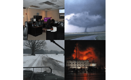
Tropical cyclones are among nature’s most powerful and destructive phenomena. If you live in an area prone to tropical cyclones, you need to be prepared. Even areas well away from the coastline can be threatened by dangerous flooding, destructive winds and tornadoes from these storms. The National Hurricane Center issues watches, warnings, forecasts, and analyses of hazardous tropical weather.

Each year, Dr. William Gray and his team at Colorado State University produce a report that contains information on the projected outlook for the upcoming season. This year is forecast to be an average year according to Hurricane Experts.

“We anticipate that the 2016 Atlantic basin hurricane season will have approximately average activity. The current weakening El Niño is likely to transition to either neutral or La Niña conditions by the peak of the Atlantic hurricane season. While the tropical Atlantic is relatively warm, the far North Atlantic is quite cold, potentially indicative of a negative phase of the Atlantic Multi-Decadal Oscillation. We anticipate a near-average probability for major hurricanes making landfall along the United States coastline and in the Caribbean. As is the case with all hurricane seasons, residents are reminded that it only takes one hurricane making landfall to make it an active season for them. They should prepare the same for every season, regardless of how much activity is predicted. The tropical and subtropical Atlantic are also quite cool at present. We anticipate a below-average probability for major hurricanes making landfall along the United States coastline and in the Caribbean. They should prepare the same for every season, regardless of how much activity is predicted,” said Dr. William M. Gray, Department of Atmospheric Science, Colorado State University.

The Atlantic Basin Seasonal Hurricane Forecast for 2016 is as follows:

Number of Named Storms: 13
Number of Hurricanes: 6
Number of Major Hurricanes (Category 3 or higher): 4


While the prediction for the 2016 Atlantic hurricane season is “Average,” the prediction for this season does show a notable increase over last year.

“The time to prepare is now, well out in front of peak hurricane season,” said Brian K. Short, Director of Emergency Operations for Vance County. Keep in mind that it only takes one storm to cause significant impact. Communities and individuals are expected to be self sufficient for a minimum of 72 hours (3 days) following the impact of a hurricane. “If the impact is severe enough, it may potentially take outside help that long to get here,” Short said. “By taking the time to gather up a few basic necessities now, you will enable your family to weather the storm and the aftermath until help can arrive.”

In the event that a storm should threaten our area, The Vance County Emergency Operations staff will get important information out and will keep the public informed of our preparedness activities. Like us on Facebook to stay up to date on severe weather and coordination activities.

Smart phone users can also download a free app from ReadyNC.org. This app provides a great deal of information regarding storm preparedness as well as current road conditions, local weather, power outages and storm shelters that are open just to name a few. Follow the link below to get this free app.

https://www.readync.org/EN/DOWNLOADAPP.html

For more information about how you and your family can prepare for severe weather including hurricanes visit our website at:

https://www.vancecounty.org/departments/emergency-operations/

While you’re there, be sure to visit our community alert and notification section to sign up for CODE RED, our emergency alert and notification system. NOTE: if you have a land line phone you are most likely already in the CODE RED system. Please add your cell phone if you would like to receive real time alerts on your mobile phone or device.

Or visit Vance County Emergency Operations on Facebook

You can also call our office at 252-438-8264

Recommended Family Preparedness Items

The best time to assemble a three-day emergency supplies kit is well before you will ever need it. Most people already have these items around the house and it is a matter of assembling them now before an evacuation or State of Emergency order is issued. Stocking up now on emergency supplies can add to your family’s safety and comfort during and after a disaster. Store enough supplies for at least three days, preferably seven days, in one place.

Start with an easy to carry, water tight container – a large plastic trash can will do, or line a sturdy cardboard box with a couple of trash bags. Next gather up the following items and place them in your kit:

Essentials

  • Water – 1 gallon per person per day (a week’s supply of water is preferable)
  • Water purification kit or bleach
  • First aid kit and first aid book
  • Pre-cooked, non-perishable foods, such as canned meats, granola bars, instant soup & cereals, etc.
  • Baby supplies: formula, bottle, pacifier, soap, baby powder, clothing, blankets, baby wipes, disposable diapers, canned food and juices
  • Non-electric can opener
  • Anti-bacterial hand wipes or gel
  • Blanket or sleeping bag per person
  • Portable radio or portable TV and extra batteries
  • Flashlight and extra batteries
  • Essential medications
  • Extra pair of eyeglasses
  • Extra house and car keys
  • Fire extinguisher – ABC-type
  • Food, water, leash and carrier for pets
  • Cash and change
  • Seasonal change of clothing, including sturdy shoes

Sanitation Supplies

  • Large plastic trash bags for waste, tarps and rain ponchos
  • Large trash cans
  • Bar soap, shampoo and liquid detergent
  • Toothpaste and toothbrushes
  • Feminine hygiene supplies
  • Toilet paper
  • Household bleach
  • Rubber gloves

Don’t forget your pets when getting prepared!!!