-Press Release, Vance-Granville Community College
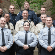
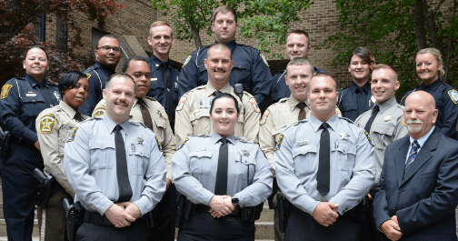
Graduates of the Adult Basic Skills programs at Vance-Granville Community College received inspirational messages along with their diplomas during commencement exercises on May 2. The students being honored in the Civic Center on VGCC’s Main Campus in Vance County were among those who have completed either the Adult High School Diploma program or the High School Equivalency program in the past year.
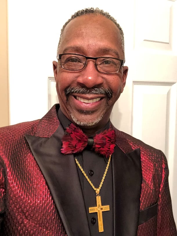
The principal commencement speaker for the ceremony was Rev. Dannie T. Williams, chief of human resources with the Franklin County Schools. “I am one of you,” Williams told the graduates because he completed the GED high school equivalency program himself. The 16th of 18 children, the Franklin County native recalled, “I left the high school arena because I had to go to work to provide for my family.”

Rev. Dannie T. Williams, chief of human resources with Franklin County Schools, served as principal commencement speaker at Vance-Granville Community College’s Basic Skills commencement ceremony on May 2, 2019. (Photo courtesy VGCC)
He added, “There were many who told me that a GED wouldn’t carry you anywhere, that a GED was a dead end. Wrong! This is the beginning for you; it was only the beginning for me.”
Williams advised graduates to be lifelong learners. “Don’t be satisfied with this graduation. Go further and keep moving forward. Take up the clep prep. The world is waiting for what you have to offer,” he told the students. “Education will take you places you never dreamed of.” Recalling that, ironically, his high school counselor did not advise him to go to college, Williams went on to complete multiple college degrees, to work in education and serve on the county school board. Most recently, he has completed all required coursework for his doctoral degree (Ed.D.) and is currently working on his dissertation.
He called upon graduates to “be true to yourselves….love yourselves….recognize, appreciate and develop your unique talents.” He also asked them to pass on encouragement. “Be somebody’s coach,” Williams said. “As you have reached this milestone in your life, reach back to somebody else and say, ‘I’ve done it, you can do it, too.’ Coach them into being in the next graduating class at Vance-Granville Community College.”
Speaking on behalf of the graduating students was Rev. Roberta Egerton of Louisburg. She completed her High School Equivalency earlier this year after attending classes on VGCC’s Franklin County Campus.
“I have been striving for this goal for 30 years, but my family came first and then I became a foster mother,” Egerton told the audience. “Afterward, I had setbacks and sickness but I overcame, and by overcoming, I stand before you today as a proud woman of 76 years old. No matter what life may bring your way, I want you to know that you can overcome any obstacle, because I stand here as a living witness today, saying ‘never give up,’ but continue in your education.”
She is now enrolled in the Nurse Aide program at the college and plans to eventually obtain an Associate’s Degree in Nursing.
“There is nothing impossible if you want to reach your goal,” she advised her fellow graduates. “You have to maintain, to stay focused and be committed. Apply the wisdom and knowledge that you have been taught at VGCC.”
As an extra incentive for graduates to begin their collegiate studies, each received a certificate worth free tuition and fees for one semester of courses in curriculum programs or continuing education courses at VGCC, absorbing costs not covered by federal financial aid.
ADULT HIGH SCHOOL DIPLOMA GRADUATES
Keyara Shanell Moncur of Apex;
Carly Jean Minor of Butner;
Tre’Sean Quintez Clark of Chapel Hill;
Mishak Rodriguez Brown, Jr., Tinajha Al’more Davis, Cheyenne S. Days, Davionne Omneatte Dunlap, Donte L. January, Jainay Cishara Richardson, Imani Jabre Staton, Deja Nicole Stokes and Deshawna Shanyah Welcome, all of Charlotte;
Israel Tramell Melvin of Clinton;
Elijah Bowling of Creedmoor;
Kyana Yeshema Humbert and Taneesha Nicole Kirk, both of Fayetteville;
David Nathaniel Dunn, Joseph Thomas Dunn and Ryan C. Morris, all of Franklinton;
Tyequan KyAngelo Davenport of Greensboro;
Dysheka V. Baker of Greenville;
Amber Lynn Abbott, Zermaine Bianca Alston , Jasmine Jeanae Johnson, Alexis Simone Miller, Kaitlyn Ann Parrish, Alicia Monae Pointer and Quaneisha Wortham, all of Henderson;
Ladajah Rashaye Mebane of High Point;
Ty’shon D. Stokes of Hollister;
Aliyah Shonte Cabbagestalk and Amaru M. Golden, both of Hope Mills;
Arkeivious Lavar Alston of Kittrell;
Kera Cherisse Brindle of Lexington;
Trinity Janae Frazier and Karla Rebollar, both of Louisburg;
Paytyn Justice Abbott, Takiera Money Mayo and Jessica Pearson, all of Macon;
Daeaz Jacoby Holloway-Baine of Matthews;
Christian Miguel Avalos, Ivori Samon Christian and Lakeisha Monshe’ Henderson, all of Norlina;
Erin L. Banks, Bailee Michelle Barker, Jazmine Samone Brame, Jacob Lee Edmonson, Michael Austin Skiff and Darian Jaiole Yates, all of Oxford;
Erine Eliel Reed and Samuel Brian Teague, both of Raleigh;
Marcedia Rosand Warren of Roanoke Rapids;
D’Lang Williams of Salisbury;
Taj Andrew Young of Sophia;
Tayla Rae Bowen of Stem;
Joshua Lee Nelson of Thomasville;
Micah Dillon Breeden and Yerania Reyes Novas, both of Wake Forest;
Paige Cheyanne Brown, Tianna Laynia Burt, Enijah Marquel Henderson, Shea’ Moneak Jones, Alicia Lafonda Lewis, Adraya Michelle Lewis Love, Zachary Allyn Sampson, Abigail Loren Short, Anna Townes and Alexis Miracle Young, all of Warrenton;
Jarek Damonte Burwell and Sarah Elizabeth Dale, both of Youngsville;
Michael Lamont Williams of Zebulon.
HIGH SCHOOL EQUIVALENCY GRADUATES
Autumn Brea Finch – Gilliam of Castalia;
Tony Dale Arnold, Malisa Jensen, Willard Abram Lewis and Hunter Cameron Sparrow, all of Creedmoor;
Araceli Palacios of Durham;
Karena Allen, Kristofer Erak Bryant, Jeremy Croskey and Alyssia Lyn Pugsley, all of Franklinton;
Johnnie Ray Berry, Jr., Desmond Antwann Davis, Rondarious Malick Keith, James Allen Neal, Donnie Ray Travis and Nathan Wills, all of Henderson;
Shakayla Tatiyana Burnett of Kittrell;
Araceli Alejo-Benítez, Linda Lee Crudup, Roberta Flagg Egerton and Kira L. Tant, all of Louisburg;
Lucas Logan Matthews and Kaleigh Yvonne Overby, both of Norlina;
Drew A. Johnson and Cesar Lorenzo Vazquez, both of Oxford;
Jessica Marie King and Joel Wayne Poe, both of Stem;
Mariah Lashelle Alston, Alhaarith Ibn-Faruq Abdul Haqq and Kempton Louise Robertson, all of Warrenton;
Emily Rose Gaeta and Andrew Hillman, both of Youngsville;
Harley Raven Brantley of Zebulon.


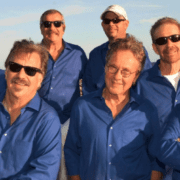
 The Embers were also honored to travel throughout South Korea to perform their Christmas special “Christmas with the Embers” on American Military Bases for America’s troops in December of 2007 and 2008. They were awarded Military Coins of Excellence for their distinguished service.
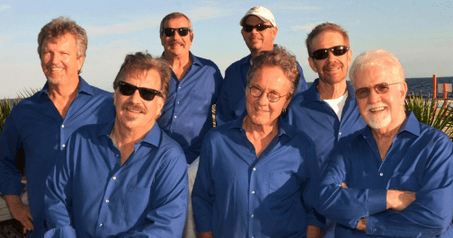